
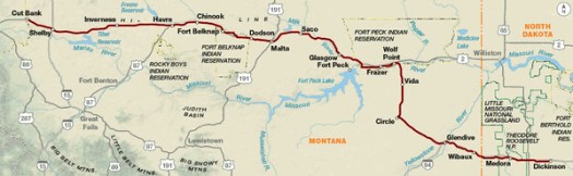
Now I will be on Northern Tier Map 3. The first 60 miles are in North Dakota, and then the route crosses into Montana around Wibaux. Some of the route is on I-94, and some on Old Hwy 10. In Wolf Point, the route gets onto U.S. 2 (known locally as the Hi-Line), and follows it all the way to Cut Bank. U.S. 2 is roughly parallel to the Great Northern (BNSF) tracks – aka The Empire Builder.
This map has two maps per panel, since there are so many straight roads, heading more or less due west. As a result, Northern Tier Map 3 covers 544 miles!
After Cut Bank, I will continue on Northern Tier Map 2. This is the first map (heading west) that includes an elevation profile!
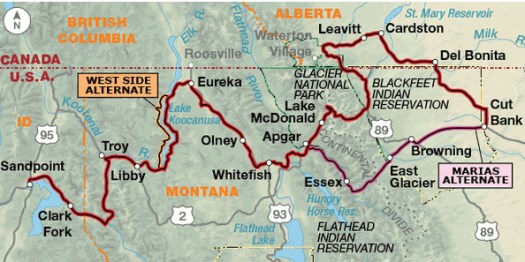
The route heads northwest from Cut Bank, into Alberta for a bit, and then back into Montana, toward Babb and St. Mary, on the east side of Glacier National Park. Part of this route is on the Great Parks North route that I rode in summer 2016.
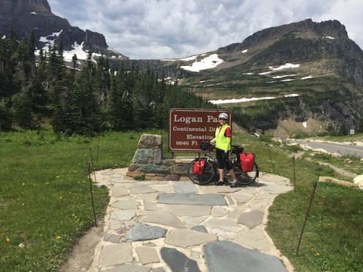
At St. Mary, I will enter Glacier National Park and head across Logan Pass on Going to the Sun Highway. This road is fantastic, with great views, hand-built stone guard walls, and lots of curves. Luckily, there are also lots of pull-outs, which are a welcome sight on the ride up the pass. Last year, I rode east-bound from Lake McDonald to St. Mary, so this year, it will be the opposite direction. The climb is a little shorter in the west-bound direction.
The Northern Tier does not go north to Banff and Jasper National Parks, but here are some pictures anyway.


After leaving Glacier National Park, the route goes through Whitefish, and then heads northwest on U.S. 93 to Eureka, then winding south and west through Libby, turning onto Forest Road 56 and finally onto Hwy 200 through Clark Fork, Idaho, and on to Sandpoint, Idaho. Most of this ride is in Kootenai National Forest, crossing the Salish and Cabinet mountains.
From Sandpoint, it is only about 35 miles (on Northern Tier Map 1) to the Washington state line!
